DE EN
Contact
STANAG Video-Ingest Pipeline
05

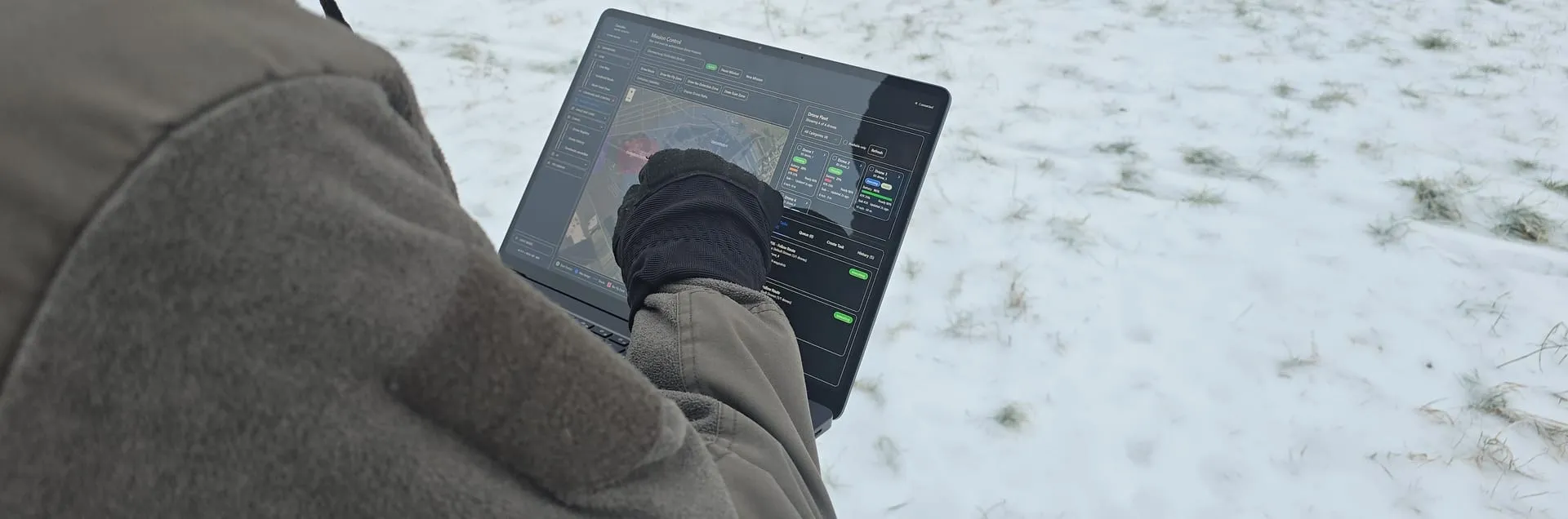
STANAG Video-Ingest Integration

April 2026

Objective

Validation of a controlled video ingest path for STANAG-4609-adjacent workflows, and preparation of the platform for standardized video and metadata processing.

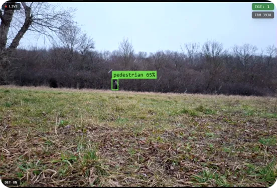
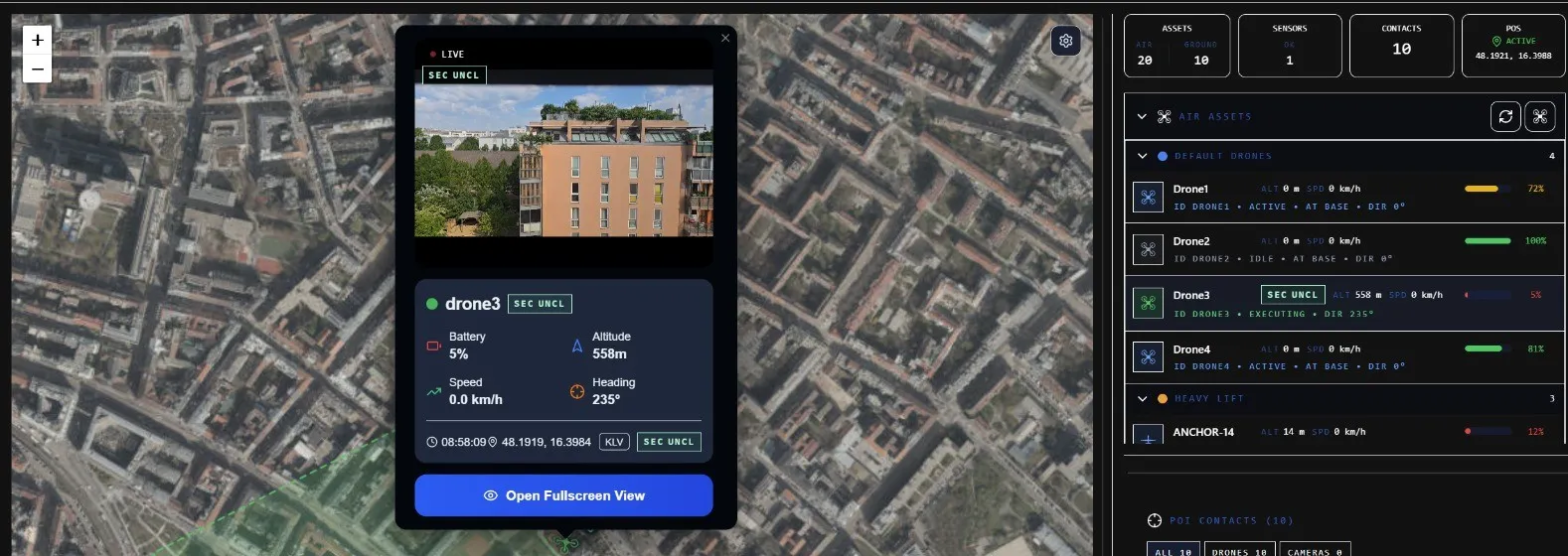
Video ingest lifecycle

The pipeline supports the controlled lifecycle of external video sources: streams are started on activation, cleanly terminated on deprovisioning and reconciled with the expected operating state after restarts.

Health monitoring, timeouts and recovery paths are a direct part of the ingest logic. This keeps video sources operationally traceable and avoids uncontrolled residual states.

The functions were validated in a simulator environment against repeated start/stop cycles, stream interruptions and service restarts. The operating state remained consistent, active sources were correctly detected and missing streams could be cleanly recovered.

STANAG context

The current development state lays the foundation for MPEG-TS-based video workflows and the further integration of MISB/KLV metadata. The goal is a standards-aligned path that brings video, telemetry and context data together for situational awareness and analysis.

This provides the technical basis for a robust video ingest platform: adopt standards, keep them controllable under operational constraints and run media processing separately from the core system.

Result: Simulator validation completed successfully. Lifecycle control, health monitoring and recovery operate reliably. MISB/KLV metadata, deeper analysis and interoperability are in the next development stage.

Validated functions

  • Controlled start and stop of external video sources
  • Health monitoring for active streams
  • Timeout-based staleness detection
  • Recovery and reconciliation after restarts
  • Isolated media paths for ingest and processing
  • Preparation for MISB/KLV metadata integration
EnvironmentDevelopment / Simulator
Standard contextSTANAG 4609, MISB / KLV
StatusSimulator validation complete
FocusVideo ingest, lifecycle, monitoring, recovery
Next stepMetadata, analysis, interoperability
04

Operational Data Layer Integration

April 2026

Objective

Integration of external geospatial datasets as persistent map layers, and validation of automated mission checks against regulatory and infrastructure data.

Geospatial data integration

Several external data sources were imported and made available as persistent layers: regulatory UAS zones, critical infrastructure (energy, communication, emergency services), aviation obstacles by altitude class and flood zones. In addition, operator-definable situation objects were introduced as a platform-internal data layer.

All layers are available offline and can be configured individually via layer menus and presets.

Mission checks

The task creation flow was extended with automatic checks against all relevant layers. Missions are checked for conflicts with flight restrictions, infrastructure and obstacles before execution.

Result: All datasets integrated successfully. The automated mission checks work reliably — detected conflicts require deliberate clearance by the operator.

Validated functions

  • Regulatory UAS zones with zone-type differentiation
  • Critical infrastructure layers (energy, communication, emergency services)
  • Aviation obstacles by altitude class
  • Flood zones by return period
  • Operator-defined situation objects
  • Automatic mission check at task creation
  • Layer menus and presets in LiveMap / Mission Control / Situational Awareness
EnvironmentDevelopment / Simulator
Data sourcesPublic
StatusSuccessfully completed
Layer typesRegulatory, infrastructure, obstacles, environment
Person detection in snowfall
03

Detection & Field Operator Validation

February 2026

Objective

Validation of person detection under adverse weather conditions, and functional testing of field operator lifecycle management.

Person detection

Test of real-time person detection using a local detection model under an overcast sky and active snowfall. The camera was positioned statically on the ground. The target person wore inconspicuous clothing in olive green and black and moved a few meters away in front of bushes — a deliberately difficult scenario with low contrast against the background.

Despite the challenging conditions, the person was reliably detected throughout. Detection remained stable even with changing positions and partial occlusion by vegetation.

Field operator validation

Validation of the complete field operator lifecycle: adding, managing and removing field operators via the platform. Registered operators transmit their position and data to the station in real time, where they are displayed live on the map.

All lifecycle operations worked flawlessly. Position data was synchronized reliably and in real time.

Result: Both functions validated successfully. Detection works robustly under adverse weather conditions and poor contrast. Field operator management is ready for operational use.

Validated functions

  • Person detection in adverse weather
  • Reliable detection despite low contrast
  • Static ground camera position with real-time analysis
  • Adding, managing and removing field operators
  • Real-time position transmission to the station
  • Live display of operators on the map
EnvironmentOutdoor, Austria
WeatherOvercast, snowfall
StatusSuccessfully completed
Detection modelLocal
Camera positionStatic, ground
Field Operator Handheld Mode
Field operator — handheld mode
MAVLink SITL mission flight
02

MAVLink Proof of Concept

February 2026

Objective

Demonstration of end-to-end MAVLink integration in the Danubis platform using MAVLink software-in-the-loop (SITL) simulation.

Summary

Proof of concept of the complete MAVLink command chain using ArduPilot software-in-the-loop (SITL) simulation. The integration is embedded directly in the platform's production mission path. QGroundControl served as an independent external validation instance.

Result: PoC completed successfully. The end-to-end functionality of the MAVLink command chain is demonstrated. The platform operates in a standards-compliant and vendor-independent manner.

Validated functions

  • Arm/disarm, takeoff, landing and emergency stop
  • Waypoint navigation and return-to-home (RTL)
  • Real-time telemetry (GPS, battery, heading, speed)
  • Multi-drone operation with parallel SITL containers
  • Automatic reconnect and lifecycle management
EnvironmentSimulator
External validationQGroundControl
StatusSuccessfully completed
ProtocolMAVLink
SimulatorArduPilot SITL
Station Operator Laptop
01

Connectivity Test

January 2026

Objective

Validation of multi-device connectivity and real-time synchronization of the Danubis platform.

Summary

First outdoor test of the Danubis platform with a focus on multi-device connectivity and real-time synchronization. Several different devices (tablet, laptop, phone) were connected over a local network and tested for synchronized mission management, POI management and video streaming.

All tests carried out were passed successfully. The measured latency was consistently below 200 ms, with a stable connection throughout the entire test period.

Result: Test completed successfully. The platform architecture is validated for use with multiple synchronized devices.

Validated functions

  • Multi-device synchronization (tablet, laptop, phone)
  • Real-time communication over a local network
  • POI synchronization between devices
  • Video stream stability under field conditions
  • Mission coordination between station and field operator
EnvironmentOutdoor, Austria
StatusSuccessfully completed
Operator with laptop
Station operator — laptop setup